1. Due 11/26
2. All students received an outline target map of their country needed to draw a historical map. Map guidelines at bottom of this page. Assigned maps here:
- Germany (Target Map link) - One 970, Two 1000, Three 1648 (use religious key only), Four 1512, Five 1270
- Italy(Target Map link) - One 1454, Two 1100
- Spain (Target Map link) - One 1270, Two - Reconquest
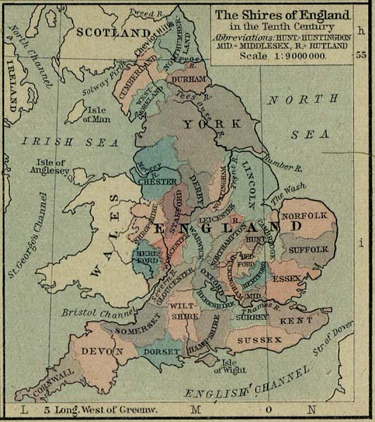
- British Isles (Target Map link) - One: shires 10th Cent., Two 600 CE, Three 1065, Four 802, Five
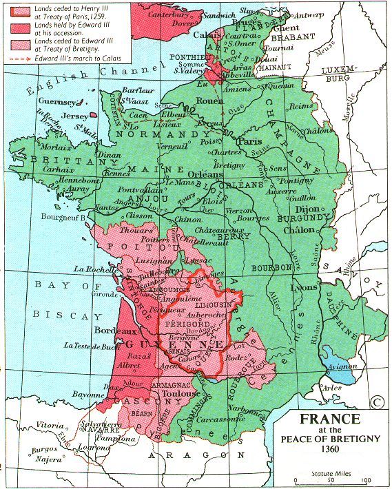
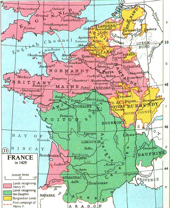
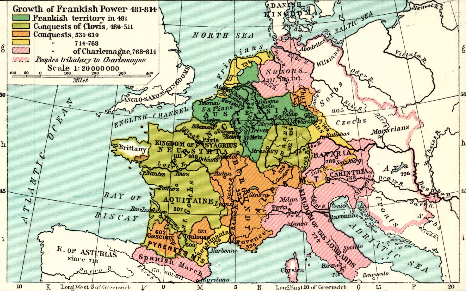
- France (Target Map link) - One 1360, Two 1429, Three 481 - 814, Four (1338 - 1360), Five
3. Artisan Guild members received a map of Western Europe needed to draw a modern map of Europe. Here are links to source maps that the Artisan members were assigned in class:
West Europe target map link
West Europe target map link
- Modern political map
- Map of EU member states - draw the political boundaries of each nation - use a key to show - date of membership, use of the Euro currency, states not part of the EU
- Topographical map of Europe - label rivers, draw mountains.
4. All maps must be colored (land only), ink outlined, titled. Key must be in ink. Different countries and regions must be labeled in black ink. Rivers should be labelled in blue ink.
No comments:
Post a Comment